
Uttar Pradesh approves base map for six-district capital region development plan
The Uttar Pradesh State Capital Region (UPSCR) has crossed a significant milestone in its formation process with the approval of its base map in a review committee meeting held at the Parijat

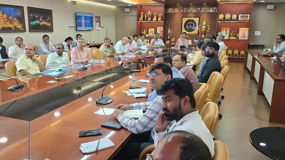
The Uttar Pradesh State Capital Region (UPSCR) has crossed a significant milestone in its formation process with the approval of its base map in a review committee meeting held at the Parijat auditorium of the Lucknow Development Authority. The meeting was chaired by Divisional Commissioner Vijay Vishwas Pant, who presided over the deliberations that culminated in this crucial approval.
The approved base map will now be presented before the Executive Committee for final ratification. Once the Executive Committee grants its approval, a GIS-based regional plan for the UPSCR will be prepared, marking the next phase in the comprehensive development blueprint for the state capital region.
The UPSCR will encompass six districts spanning a vast geographical area. Lucknow, Sitapur, Unnao, Hardoi, Barabanki and Raebareli have been included in the State Capital Region, which covers a total area of approximately 26,741 square kilometers. Under the regional master plan, 30 major projects have been identified covering transport, mobility, economy, infrastructure and tourism sectors.
The connectivity enhancement and infrastructure development plans for the UPSCR are extensive and ambitious. To strengthen connectivity among the six districts, projects such as the State Capital Mala (regional road), elevated peripheral road and road upgradation have been proposed. Additionally, plans include the development of a Transport Nagar, orbital rail corridor and metro network expansion.
Economic development forms a core component of the regional planning exercise. Industrial development, logistics parks, food parks and Lucknow-Kanpur Expressway corridor-oriented development are among the projects that have been identified to boost economic activities in the region. It is believed that these projects will increase investment opportunities, employment generation and new business avenues in the area.
The base map preparation process involved extensive inter-departmental coordination and consultation. Opinions were sought from 22 institutions including development authorities, revenue department, public works department, railways, forest department, municipal corporations, irrigation department and the town and country planning department. All departments examined the base map and gave their consent before it was presented and approved in the review committee meeting.
To ensure the authenticity and accuracy of the base map, ground truthing was conducted across all six districts of the UPSCR. Consultants and concerned departments physically verified data obtained from satellite images and maps by visiting sites on the ground. During this entire verification process, physical validation was carried out at 2,239 locations, ensuring that the digital mapping corresponded accurately with ground realities.
The meeting saw the participation of several senior officials who contributed to the review and approval process. Additional District Magistrate Rakesh Singh, Additional Municipal Commissioner Pankaj Srivastava, Additional Secretary C.P. Tripathi, Chief Town Planner K.K. Gautam, along with other officers and consultants were present during the deliberations.
With the base map approval secured, the focus now shifts to accelerating the preparation of the regional plan, which will provide a comprehensive development framework for the 26,741 square kilometer region. The GIS-based regional plan is expected to integrate the identified 30 projects into a cohesive development strategy that will guide infrastructure investment, urban planning and economic growth across the six-district State Capital Region in the coming years.
Frequently asked questions
What is the Uttar Pradesh State Capital Region (UPSCR)?
The UPSCR is a planned regional development area encompassing six districts: Lucknow, Sitapur, Unnao, Hardoi, Barabanki, and Raebareli, covering approximately 26,741 square kilometers.
What was approved in the recent review committee meeting?
The base map for the UPSCR was approved by the review committee. It will now be presented to the Executive Committee for final ratification before a GIS-based regional plan is prepared.
How many major projects have been identified for the UPSCR?
Thirty major projects have been identified covering transport, mobility, economy, infrastructure, and tourism sectors, including connectivity enhancements, industrial development, logistics parks, and metro network expansion.
How was the accuracy of the base map verified?
Ground truthing was conducted across all six districts with physical validation at 2,239 locations to ensure digital mapping corresponded accurately with ground realities. Consultants and departments verified data obtained from satellite images and maps by visiting sites on the ground.
You may also like


Most read
- 1
Tesla audits Chinese suppliers to scale up Optimus robot production
- 2
Former minister Lakhan Singh Rajput to inaugurate temple bhandara at Shri Chakreshwar Mahadev
- 3
Firozabad BSA finds four government schools locked during inspection
- 4
Tamil Nadu dengue cases fall for third consecutive year to 17,049
- 5
Social workers stage silent protest at Fufund railway station for train halts
Comments
No comments yet. Be the first to comment.