
Lakkundi's hidden temples and wells revealed through six-month LiDAR survey
Archaeological authorities deploy LiDAR, radar, and drone technology to map concealed temples and wells across medieval Lakkundi in Karnataka.

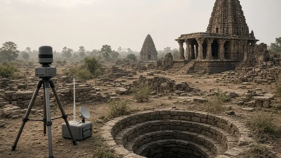
Archaeological authorities have commissioned a six-month technology-driven investigation to map concealed monuments across Lakkundi, a medieval urban centre in Gadag district where local tradition claims the existence of 101 wells and 101 temples, most of which remain hidden.
The Department of Archaeology Museums and Heritage (DAMH) will partner with the National Institute of Advanced Studies, Bengaluru, deploying Light Detection and Ranging (LiDAR) surveys, ground penetrating radar, GIS mapping, remote sensing, drone documentation and photogrammetry to locate structures obscured by time and vegetation.
An MoU formalizing the collaboration was signed on August 27.
Why the search matters
There is a perception that Lakkundi's known monuments represent only part of its archaeological story, and the site may hold more than what is currently visible on the surface, according to authorities. The outcome at the end of six months is expected to present a more precise picture of the heritage landscape.
Lakkundi, known as Lokki-Gundi in inscriptions, was a prominent urban centre between the 10th and 12th centuries CE and occupies an important position in Indian architectural history. Its conserved monuments belong to the Kalyana-Chalukya period, and art historians note the temples exhibit a hybrid or Vesara style blending Nagara, Dravida and Bhumija traditions.
From satellite to spade
NIAS will study old photographs, undertake remote sensing and scan the area to identify potential locations of buried or concealed structures, said A. Devaraju, Commissioner, DAMH. The information could help the department narrow locations for excavation rather than relying on conventional surveys covering a large area, according to authorities.
Senior NIAS officials recently made a presentation on the use of LiDAR and other digital technologies in archaeological excavations to map and pinpoint artefacts under vegetation or overgrowth, paving the way for the MoU, Mr. Devaraju added.
The issue was first discussed by then Minister H.K. Patil with former ISRO chairman Kiran Kumar, who mooted the idea of using LiDAR and suggested that NIAS could be roped in, Mr. Devaraju said.
Heritage listing and replication
The project assumes significance as the State government is preparing a detailed project report to propose Lakkundi for inclusion in the tentative list of UNESCO World Heritage Sites.
As per the MoU, a Joint Coordination Committee will be constituted by both institutions to oversee the operations. Officials stated the initiative will serve as a new roadmap for the sustainable development, conservation and management of monuments and cultural heritage sites.
Similar technology-based studies are proposed for the ancient sites of Nagavi, the site of an ancient place of learning in Chittapur, Kalaburagi district, and Rajghatta near Doddaballapur. "Once the exercise in Lakkundi is completed, we plan to involve NIAS for similar studies at Nagavi and Rajghatta as well," said Mr. Devaraju.
Source: The Hindu
Frequently asked questions
What is the Lakkundi survey investigating?
A six-month technology-driven investigation is mapping concealed monuments across Lakkundi, a medieval urban centre in Gadag district. Local tradition claims the site contains 101 wells and 101 temples, most of which remain hidden beneath vegetation and time.
What technologies are being used in the survey?
The Department of Archaeology Museums and Heritage is partnering with the National Institute of Advanced Studies to deploy Light Detection and Ranging (LiDAR), ground penetrating radar, GIS mapping, remote sensing, drone documentation, and photogrammetry to locate obscured structures.
Why is Lakkundi archaeologically significant?
Lakkundi was a prominent urban centre between the 10th and 12th centuries CE during the Kalyana-Chalukya period. Its temples exhibit a hybrid Vesara architectural style blending Nagara, Dravida, and Bhumija traditions, making it important to Indian architectural history.
How does this project support UNESCO World Heritage status?
The project assumes significance as the State government is preparing a detailed project report to propose Lakkundi for inclusion in UNESCO's tentative list of World Heritage Sites.
Will this technology be used at other sites?
Yes, similar technology-based studies are proposed for the ancient sites of Nagavi in Kalaburagi district and Rajghatta near Doddaballapur. Once the Lakkundi exercise is completed, NIAS plans to conduct similar surveys at these locations.
You may also like


Most read
- 1
Tesla audits Chinese suppliers to scale up Optimus robot production
- 2
Former minister Lakhan Singh Rajput to inaugurate temple bhandara at Shri Chakreshwar Mahadev
- 3
Firozabad BSA finds four government schools locked during inspection
- 4
Tamil Nadu dengue cases fall for third consecutive year to 17,049
- 5
Social workers stage silent protest at Fufund railway station for train halts
Comments
No comments yet. Be the first to comment.