
UP Rain Toll At 13 As Flood-Like Conditions Put States On Alert
Heavy rain in Uttar Pradesh killed 13 people and injured 17 as flood-like conditions, strong winds and overflowing rivers put several states on alert.

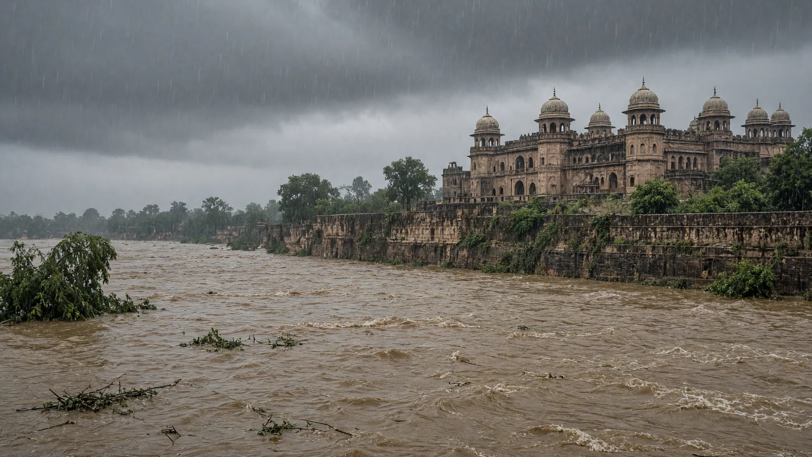
Rain has intensified flood-like conditions across several parts of India, with Uttar Pradesh reporting 13 deaths and 17 injuries in separate rain-related incidents as heavy showers, strong winds and overflowing rivers damaged homes, crops and public infrastructure.
Widespread rain leaves several states on alert
Several parts of the country have seen a sudden turn in weather, and the impact has been severe across multiple states.
Continuous torrential rain in Uttar Pradesh, Chhattisgarh, Uttarakhand and Himachal Pradesh has created flood-like conditions in many areas.
The rain has also caused considerable loss of life and property, according to the reported situation across these states.
In the national capital, light rain on Saturday brought the temperature below normal, after which the India Meteorological Department had issued a yellow alert.
The IMD estimated that Delhi’s maximum temperature on Sunday could remain between 30 and 32 degrees Celsius, while the minimum temperature was likely to be recorded around 21 to 23 degrees Celsius.
For 27 September, the weather department said rain and stormy conditions could continue in many parts of the country.
According to the weather department, rain activity may be seen in around 15 states during the next 8 hours.
Some areas may also experience thunderstorms with strong winds.
The forecast covered parts of north-west India, including Uttar Pradesh, Delhi, Himachal Pradesh, Jammu and Kashmir and Rajasthan, where changes in weather were expected.
The weather department said the effect of rain may be stronger in eastern Uttar Pradesh on Sunday.
Himachal Pradesh was forecast to receive very heavy rain at some places.
Delhi too could see rain and strong winds.
Uttar Pradesh sees deaths, injuries and major damage
According to the weather department, a depression over south-eastern Uttar Pradesh moved towards the north-north-west.
Because of this system, rain was expected to continue on Sunday as well.
Uttar Pradesh has reported 13 deaths in separate incidents linked to heavy rain, while 17 people were said to be injured.
Several areas have also faced the risk of flooding and sudden waterlogging.
In the past 24 hours, the state received 19 times more rain than normal.
The intense rainfall destroyed standing crops and completely damaged 117 kutcha houses.
Five people died after kutcha walls and houses collapsed.
Another 5 people lost their lives in accidents caused by uprooted trees amid strong winds and heavy rain.
Reports of loss of life came from Lakhimpur Kheri, Amethi, Barabanki and Gorakhpur districts.
In China village of Lucknow, three members of the same family were injured after the wall of a mud house collapsed.
They were rescued safely and admitted to hospital.
In Kannauj, continuous rain damaged 20 kutcha houses.
Rivers were in spate in several districts, including Banda, Varanasi, Unnao, Prayagraj, Shravasti, Etah, Badaun, Gorakhpur, Bareilly, Balrampur and Pilibhit.
Hospitals and public places were submerged in water in several affected districts.
Crops were also destroyed in these areas.
Cyclonic weather and storms brought down trees and electric poles at many places.
The fall of trees and electric poles also affected power supply.
More rain forecast for eastern and western Uttar Pradesh
Rain is expected to continue affecting Uttar Pradesh on 27 September.
According to the weather department, several places in eastern Uttar Pradesh may receive rain.
Some areas of eastern Uttar Pradesh may receive heavy rain.
Western Uttar Pradesh may also see rain at some places.
Thunderstorms and strong winds were forecast during this spell.
In eastern Uttar Pradesh, wind speed on 27 September may reach 30 to 40 kilometres per hour.
Western Uttar Pradesh may also see gusty strong winds.
The weather department forecast heavy rain in parts of both eastern and western Uttar Pradesh on 27 September.
The outlook matters because the state is already dealing with deaths, injuries, damaged homes, destroyed standing crops, overflowing rivers, submerged public spaces and power supply disruptions linked to the ongoing rain.
The risk is especially significant in areas where flood-like conditions and sudden waterlogging have already emerged.
The forecast of more rain follows a 24-hour period in which the state received 19 times more rain than normal.
Bihar may see rain, thunderstorms and strong winds
Bihar may see bad weather on Sunday.
Rain and thunderstorms may develop in several parts of the state.
Because rain activity is continuing in eastern India, some parts of Bihar may feel its effect.
The weather department’s forecast also mentioned the possibility of heavy rain in the state.
Strong winds and stormy conditions may occur during the rain.
The weather impact may be felt more in open areas.
The rain spell in Bihar did not show signs of completely stopping even after 26 September.
The forecast places Bihar among the areas where rain activity may continue alongside thunder and wind, rather than as an isolated shower event.
Delhi forecast: rain from morning to afternoon, strong winds possible
Delhi may see rain along with stormy conditions on 27 September.
According to the weather department, rain activity may be seen in Delhi on 26 and 27 September.
On 27 September, light to moderate rain is expected from morning to afternoon.
Some places may receive rain with thunderstorms.
During this period, strong winds may blow at a speed of 30 to 40 kilometres per hour.
Rain coverage is expected to be wider in Delhi and surrounding areas during 26-27 September.
The forecast follows light rain in Delhi on Saturday, after which the temperature fell below normal.
The India Meteorological Department had issued a yellow alert for Delhi in view of the weather situation.
The IMD estimated that on Sunday the maximum temperature in Delhi could remain between 30 and 32 degrees Celsius.
It also estimated that the minimum temperature could be around 21 to 23 degrees Celsius.
The Delhi forecast combines two elements: rainfall and wind, with a possible spell from morning to afternoon and gusts strong enough to be specifically highlighted by the weather department.
Himachal Pradesh may see heavy to very heavy rain
Himachal Pradesh may see more active weather on Sunday.
The weather department forecast heavy to very heavy rain at some places in the state.
After rain activity increased from 26 September, its impact could be seen more strongly on 27 September.
Several areas may receive rain with thunderstorms and strong winds.
Very heavy rain is possible at isolated places in Himachal Pradesh on 27 September.
After this, heavy rain is also forecast at some places on 28 September.
The forecast is important because Himachal Pradesh is already among the states where continuous torrential rain has created flood-like conditions.
It is also among the areas where heavy rain with snowfall has caused considerable difficulties, according to the reported situation in Kinnaur.
The combination of heavy rain, very heavy rain at some places and thunderstorms with strong winds keeps the state in an active weather phase over successive forecast days.
Rajasthan, Jammu and Kashmir also face changing conditions
Rajasthan may see a change in weather from 27 September.
According to the weather department, some places in eastern Rajasthan may see rain and thunderstorm activity between 27 and 29 September.
Strong winds are also possible in eastern Rajasthan on 27 September.
However, rain conditions will not be the same across all parts of the state.
Rain activity may remain limited in western Rajasthan.
In the weather department’s forecast, eastern Rajasthan was described as the more active area over the next few days.
In Jammu and Kashmir, signs pointed to increasing activity over the next two days rather than a major change in weather on Sunday.
According to the weather department, thunderstorm and strong wind conditions may develop in Jammu and Kashmir and nearby areas on 28 and 29 September.
On these days, wind speed may reach 40 to 50 kilometres per hour and may go up to 60 kilometres per hour with gusts.
For 27 September, there was no indication of widespread rain in the state, but a changing weather situation may persist.
The forecast therefore separates Jammu and Kashmir from areas expecting more immediate widespread rain, while still pointing to possible stronger activity on 28 and 29 September.
Chhattisgarh faces heavy rain damage
Apart from Uttar Pradesh, heavy rain has caused devastation in parts of Chhattisgarh.
The affected areas named in Chhattisgarh include Gariaband, Rajnandgaon, Baloda Bazar and Bastar.
The Shivnath river in Rajnandgaon was in flood.
In Bastar and Jagdalpur, torrential rain over the past 5 days broke a 15-year record.
The administration rescued hundreds of people in these areas.
The Chhattisgarh situation shows that the ongoing weather impact is not confined to Uttar Pradesh, with flooding, record rain and rescue operations reported from different parts of the state.
Rising rivers after rain in Nepal affect nearby areas
Heavy rain in Nepal caused the water levels of the Kosi and Gandak rivers to rise rapidly.
Because of the rise in river levels, people in coastal areas were stranded.
This development adds to the wider flood concern across the region, where heavy rain has already pushed rivers into spate in several districts of Uttar Pradesh.
The Kosi and Gandak rise was linked in the source to heavy rain in Nepal, while the Uttar Pradesh river situation was linked to heavy rainfall across several districts.
Madhya Pradesh, Uttarakhand and border areas report trouble
In Madhya Pradesh, the Ken and Madasan rivers were in spate in Mandla and Panna.
In Himachal Pradesh’s Kinnaur and Uttarakhand’s Chamoli, Tehri and border areas, heavy rain along with snowfall created considerable difficulties.
Uttarakhand was also listed among the states where continuous torrential rain has created flood-like conditions.
These reports underline how the active weather system has affected both river conditions and higher-altitude areas, with rain and snowfall both appearing in the same broader weather disruption.
Why the current spell matters
The weather situation matters because the rain is not limited to one state or one type of impact.
In Uttar Pradesh, the same spell has been associated with deaths, injuries, damaged kutcha homes, destroyed standing crops, submerged public spaces, overflowing rivers and affected power supply.
In Chhattisgarh, heavy rain has been linked to flooding in the Shivnath river, a broken 15-year rain record in Bastar and Jagdalpur, and the rescue of hundreds of people by the administration.
In Delhi, the impact has been seen through below-normal temperatures after light rain and a yellow alert issued by the India Meteorological Department.
In Bihar, the weather department has forecast rain, thunderstorms, heavy rain possibility, strong winds and stormy conditions.
In Himachal Pradesh, heavy to very heavy rain at some places was forecast, and heavy rain with snowfall had already caused trouble in Kinnaur.
In Rajasthan, the forecast distinguished between eastern Rajasthan, where rain and thunderstorms may occur between 27 and 29 September, and western Rajasthan, where rain activity may remain limited.
In Jammu and Kashmir, the forecast pointed to stronger activity on 28 and 29 September, with winds possibly reaching 40 to 50 kilometres per hour and going up to 60 kilometres per hour with gusts.
The changing weather is therefore spread across northern, north-western, central and eastern parts of the country, with different states facing rain, winds, flooding, snowfall, waterlogging and river rise in different combinations.
State-wise forecast and reported impact
Uttar Pradesh remains a key concern because the weather department said rain may continue after the depression over south-eastern Uttar Pradesh moved towards the north-north-west.
The state has already recorded 13 deaths and 17 injuries in separate heavy rain-related incidents.
Standing crops and 117 kutcha houses were completely destroyed after rainfall in the past 24 hours reached 19 times the normal level.
Five deaths were linked to the collapse of kutcha walls and houses, while 5 deaths were linked to accidents caused by uprooted trees in strong winds and heavy rain.
Lakhimpur Kheri, Amethi, Barabanki and Gorakhpur districts reported loss of life.
Kannauj reported damage to 20 kutcha houses due to continuous rain.
Banda, Varanasi, Unnao, Prayagraj, Shravasti, Etah, Badaun, Gorakhpur, Bareilly, Balrampur and Pilibhit were among the districts where rivers were in spate.
Delhi is expected to see light to moderate rain from morning to afternoon on 27 September, with thunderstorms possible at some places.
Strong winds in Delhi may blow at 30 to 40 kilometres per hour.
Delhi and nearby areas may see a wider spread of rain during 26-27 September.
Bihar may see rain and thunderstorms in several parts, and the forecast also mentioned the possibility of heavy rain.
Strong winds and stormy conditions may develop during rain in Bihar, with the impact likely to be felt more in open areas.
Himachal Pradesh may receive heavy to very heavy rain at some places, with thunderstorms and strong winds in several areas.
Very heavy rain may occur at isolated places in Himachal Pradesh on 27 September, and heavy rain may continue at some places on 28 September.
Eastern Rajasthan may see rain and thunderstorms between 27 and 29 September, with strong winds possible on 27 September.
Western Rajasthan may see limited rain activity.
Jammu and Kashmir did not have a signal of widespread rain for 27 September, but weather change may continue.
On 28 and 29 September, Jammu and Kashmir and nearby areas may see thunderstorms and strong winds, with speeds possibly reaching 40 to 50 kilometres per hour and 60 kilometres per hour with gusts.
Chhattisgarh has seen heavy rain damage in Gariaband, Rajnandgaon, Baloda Bazar and Bastar.
In Bastar and Jagdalpur, 5 days of torrential rain broke a 15-year record, and the administration rescued hundreds of people.
Madhya Pradesh’s Mandla and Panna saw the Ken and Madasan rivers in spate.
Uttarakhand’s Chamoli, Tehri and border areas faced difficulties because of heavy rain with snowfall.
The Kosi and Gandak rivers rose rapidly because of heavy rain in Nepal, leaving people stranded in coastal areas.
Outlook
The immediate forecast points to continuing rain, thunderstorms and strong winds across several regions on 27 September, with Uttar Pradesh, Bihar, Delhi, Himachal Pradesh and eastern Rajasthan among the areas specifically mentioned by the weather department.
For some places, the active spell extends beyond 27 September, including heavy rain in Himachal Pradesh on 28 September, rain and thunderstorms in eastern Rajasthan between 27 and 29 September, and stronger wind activity in Jammu and Kashmir on 28 and 29 September.
The reported impact so far includes flood-like conditions, deaths, injuries, damaged homes, destroyed crops, submerged hospitals and public places, disrupted power supply, rescue operations and rising river levels.
With several states already facing damage and the weather department forecasting more rain and winds, the current spell remains a multi-state weather event rather than a localised disturbance.
Frequently asked questions
How many deaths were reported in Uttar Pradesh due to rain-related incidents?
Uttar Pradesh reported 13 deaths and 17 injuries in separate incidents linked to heavy rain.
Which states are facing flood-like conditions due to heavy rain?
Flood-like conditions were reported in parts of Uttar Pradesh, Chhattisgarh, Uttarakhand and Himachal Pradesh.
What damage was reported in Uttar Pradesh after the heavy rain?
The rain destroyed standing crops, completely damaged 117 kutcha houses, and caused deaths from house collapses and uprooted trees.
What weather alert was issued for Delhi?
The India Meteorological Department issued a yellow alert for Delhi after light rain brought temperatures below normal.
What was the forecast for rain on 27 September?
The weather department said rain and stormy conditions could continue in many parts of the country, with rain activity possible in around 15 states over the next 8 hours.
You may also like
 Uttar Pradesh
Ajay Rajvar named federation’s UP chief general secretary
 International
China’s Hybrid Car Exports to EU Surge 204% Ahead of Import Cap
 National
Nagaland State Lottery to Announce Dear Monday Draws on October 19
 Sports
Roshan Kumar Fetches Rs 15,500, Becomes UP 34 Premier League’s Costliest Buy
Most read
- 1
Air China Adds Extra Flight for Passengers Stranded in Fuel-Starved Cuba
- 2
Western disturbance to bring rain, hail and strong winds across north India
- 3
Yogi Adityanath Directs No Occupied Houses Be Demolished for Achhalda Bridge
- 4
Gwalior Temple Truck Crash Kills 12, Injures 28-29 Devotees During Navratri
- 5
Schools Shut in Five Tamil Nadu Districts, Including Chennai, Amid Heavy Rain
Comments
No comments yet. Be the first to comment.