
Hyderabad Police identifies 156 waterlogging hotspots ahead of monsoon
Hyderabad Police map 156 waterlogging hotspots to prevent traffic disruptions during monsoon. Key areas include Secunderabad and Jubilee Hills.

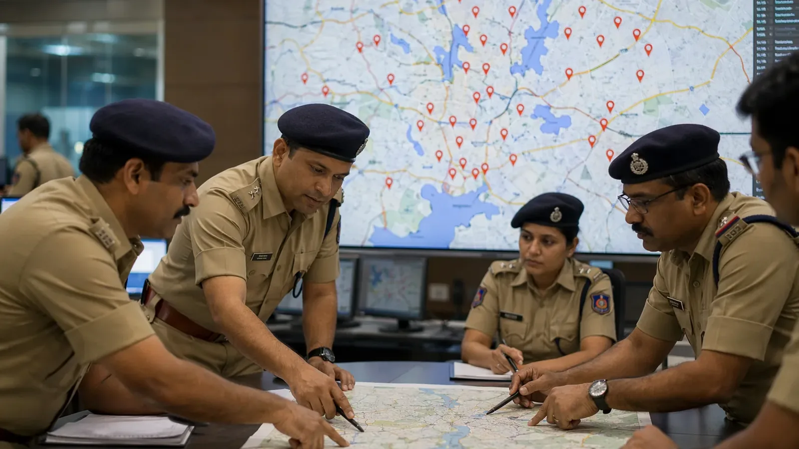
Monsoon Watch: Police Map 156 Waterlogging Hotspots Within Hyderabad Commissionerate Limits
Hyderabad is gearing up for an active monsoon season, with the City Police Commissionerate identifying 156 waterlogging hotspots across its jurisdiction as part of its preparedness measures. These locations, categorized into 48 major, 49 medium, and 59 minor waterlogging points, span eight traffic zones in the city. The initiative aims to prevent traffic disruptions on critical roads during heavy rains.
The Secunderabad traffic zone has the highest number of vulnerable points at 31, followed by Khairatabad with 28, Jubilee Hills with 27, and Golconda with 26. Other zones include Chandrayangutta with 17 points, Rajendranagar with 11, Charminar with nine, and Shamshabad with seven.
Key traffic corridors such as Panjagutta, Ameerpet, Secunderabad, Jubilee Hills, Tolichowki, Attapur, and Malakpet are among the most affected areas, with underpasses and low-lying junctions particularly prone to flooding. These routes witness heavy commuter movement daily, making them critical focus areas for the authorities.
Hyderabad City Police Commissioner V.C. Sajjanar stated that preparations began two to three months in advance, with efforts focused on identifying vulnerable points and coordinating with civic and utility agencies like GHMC, HYDRA, HMWS&SB, and TGSPDCL. "Preventive measures have been taken to address waterlogging and manage traffic congestion during the monsoon," he said.
To mitigate the impact of heavy rains, the police have deployed additional traffic personnel at critical junctions, enhanced real-time monitoring through command-and-control systems, and implemented diversion and traffic management plans for flood-prone areas.
Despite these measures, commuters report ongoing challenges during the monsoon. A software professional traveling between Marredpally and Hitec City highlighted persistent issues on the Panjagutta and Ameerpet stretches, where even brief rainfall can cause significant delays. "What should be a 30-minute commute often becomes close to an hour," he said.
Similar concerns have been raised by residents on social media. A frequent user of the PVNR Expressway from Attapur noted that waterlogging and traffic diversions often lead to widespread congestion. "Once a few vehicles slow down or break down, traffic starts piling up, and alternate routes get clogged as well," he said.
Police officials assured that personnel are stationed at critical locations and that command-and-control systems are actively monitoring conditions to enable swift deployment of resources when needed. Commissioner Sajjanar also urged residents to adjust their travel habits during the rainy season to help ease congestion.
Frequently asked questions
How many waterlogging hotspots has Hyderabad Police identified?
Hyderabad Police Commissionerate has identified 156 waterlogging hotspots across its jurisdiction, categorized into 48 major, 49 medium, and 59 minor waterlogging points spanning eight traffic zones in the city.
Which traffic zone has the most waterlogging hotspots?
The Secunderabad traffic zone has the highest number of vulnerable points at 31, followed by Khairatabad with 28, Jubilee Hills with 27, and Golconda with 26.
What measures has Hyderabad Police taken to manage monsoon-related traffic disruptions?
The police have deployed additional traffic personnel at critical junctions, enhanced real-time monitoring through command-and-control systems, and implemented diversion and traffic management plans for flood-prone areas. Preparations began two to three months in advance with coordination from civic and utility agencies like GHMC, HYDRA, HMWS&SB, and TGSPDCL.
Which areas experience the most severe waterlogging issues?
Key traffic corridors including Panjagutta, Ameerpet, Secunderabad, Jubilee Hills, Tolichowki, Attapur, and Malakpet are among the most affected areas, with underpasses and low-lying junctions particularly prone to flooding.
You may also like
 Weather
Heavy rain floods Hyderabad as Ganesh Chaturthi devotees brave traffic chaos
 National
Heavy downpour exposes Bareilly's crumbling drainage system, floods homes
 Weather
Heavy rainfall floods Raebareli villages, disrupting daily life and schools
 Weather
Heavy rains bring Varanasi to standstill, multiple areas submerged under water
Most read
- 1
Air China Adds Extra Flight for Passengers Stranded in Fuel-Starved Cuba
- 2
Western disturbance to bring rain, hail and strong winds across north India
- 3
Yogi Adityanath Directs No Occupied Houses Be Demolished for Achhalda Bridge
- 4
Gwalior Temple Truck Crash Kills 12, Injures 28-29 Devotees During Navratri
- 5
Schools Shut in Five Tamil Nadu Districts, Including Chennai, Amid Heavy Rain
Comments
No comments yet. Be the first to comment.