
Bhopal Master Plan 2047 Draft Expands City Limits To 254 Villages
The draft of the Bhopal Master Plan-2047 has laid out how the city is proposed to develop over the next two decades, with the planning area expanded to 1016.90 square kilometres and 254 villages

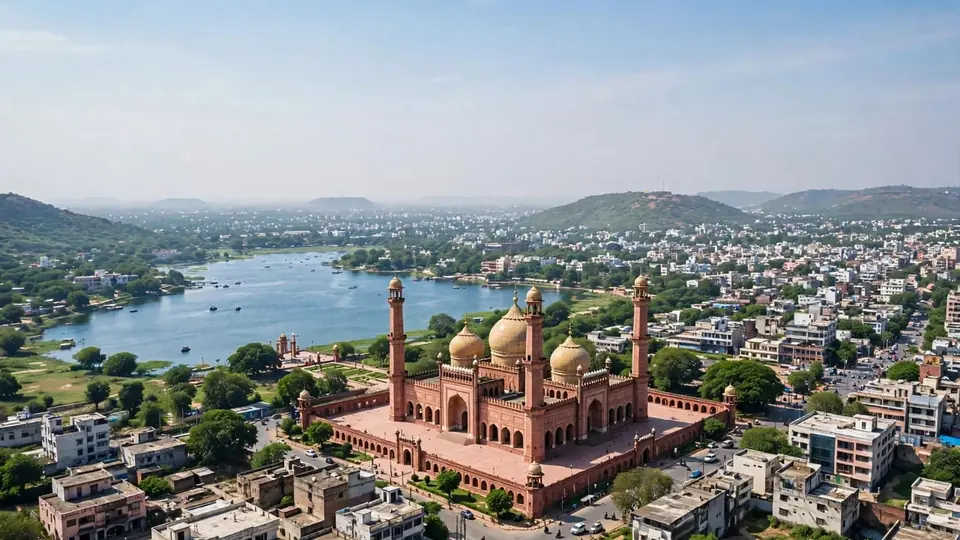
The draft of the Bhopal Master Plan-2047 has laid out how the city is proposed to develop over the next two decades, with the planning area expanded to 1016.90 square kilometres and 254 villages brought within its scope.
Prepared with an estimated population of about 45 lakh in mind, the draft plan proposes a new development map for housing, roads, employment, greenery, transport, modern civic facilities and environmental protection. The plan also underlines that the transformation will not be limited to the existing city, but will also change the profile of villages included in the expanded planning area.
A major feature of the draft is the proposal to keep the green area at around 27%. The plan also proposes a 51 km long growth corridor to accelerate urban development, a new EKAI City, and transit-based development. Along with this, changes in building rules have been proposed, including linking FAR to the width of roads and easing several older restrictions.
Bhopal’s previous development plan was prepared in 2005. At that time, the plan covered 601.06 square kilometres and included 146 villages. In the new draft, the area has increased to 1016.90 square kilometres, while the number of villages has gone up to 254. This means the planning area has expanded by 415 square kilometres compared with the 2005 plan.
The Bhopal of 2047, according to the draft, is to be built on four broad foundations. These are natural ecosystem and environmental protection, modern and citizen-centric urban planning, reform and transformation-based development, and promotion of self-reliance and economic activities.
The draft also lays stress on protecting Bada Talab, its catchment, hills, forest areas and areas used for the movement of tigers. These ecological features have been placed at the centre of the planning approach, along with the proposed expansion of the urban area and civic infrastructure.
The proposed 51 km growth corridor is planned to connect the airport, the proposed CMU and other major areas. In the same area, the draft proposes the development of EKAI, or Education Knowledge Artificial Intelligence City. The existing education hub at Bhouri is proposed to be expanded so that education, research and AI-based activities can be promoted there.
The share of green area is proposed to rise significantly compared with the 2005 master plan. In the 2005 master plan, the green area was around 16%. In the new draft, it is proposed to be increased to 27.01%. Under the redevelopment of Bhanpur Khanti, a golf course has also been proposed at the site.
The draft master plan has fixed the proposed use of a total of 61,017.02 hectares of land. Of this, 26,755.50 hectares are proposed for residential use. Green area has been proposed over 16,489.94 hectares, while 5,793.82 hectares are proposed for transport.
The plan further proposes 4,887.97 hectares for public use, 2,448.84 hectares for mixed use, 2,137.25 hectares for industrial use and 1,348.97 hectares for commercial use. The residential land use works out to 43.85% in the proposed plan.
The construction rules are also proposed to be made easier. The draft includes provisions for ending plot deduction, changing setback rules and deciding FAR on the basis of road width. These changes are part of the broader proposal to simplify rules and align development permissions with the new urban structure.
For economically weaker sections, the draft focuses on affordable and rental housing. It also proposes multilevel and mechanised parking, reflecting the plan’s emphasis on both housing access and parking management.
For monitoring and governance, the draft proposes CCTV in public places and digital monitoring of development works. A system such as a digital twin city has also been proposed for this purpose, so that implementation and urban development can be tracked digitally.
In summary, the Bhopal Master Plan-2047 draft proposes a total planning area of 1016.90 square kilometres, inclusion of 254 villages, an estimated population of 45 lakh, 27.01% green area, a 51 km growth corridor, 43.85% land for residential use and EKAI City for education, research and AI-based development.
The plan is still at the draft stage. The final plan may see changes in its provisions after objections, suggestions and modifications at the government level.
Frequently asked questions
What is the proposed planning area under the Bhopal Master Plan 2047 draft?
The draft expands Bhopal’s planning area to 1016.90 square kilometres, covering 254 villages.
How does the 2047 draft compare with Bhopal’s 2005 development plan?
The 2005 plan covered 601.06 square kilometres and 146 villages, while the 2047 draft increases this to 1016.90 square kilometres and 254 villages.
What share of green area is proposed in the new draft plan?
The draft proposes increasing the green area to about 27.01%, compared with around 16% in the 2005 master plan.
What are some major development proposals in the draft master plan?
Key proposals include a 51 km growth corridor, EKAI or Education Knowledge Artificial Intelligence City, transit-based development, and changes to building rules such as linking FAR to road width.
Which ecological areas does the draft plan seek to protect?
The draft stresses protection of Bada Talab, its catchment, hills, forest areas and areas used for tiger movement.
You may also like
 Politics
Government approves Master Plan for Delhi, 2047, reshaping city's two-decade development blueprint
 Madhya Pradesh
Madhya Pradesh Relaunches Public Bus Service After 21 Years With 351 Buses
 Gujarat
Auroville to establish information centres in every Indian district
 Kerala
Kozhikode's free public parking plan stalls as unused government land sits idle
Most read
- 1
InnoCare, Eli Lilly Sign Research And Licensing Deal Worth Up To $3.35 Billion
- 2
Former minister Lakhan Singh Rajput to inaugurate temple bhandara at Shri Chakreshwar Mahadev
- 3
Firozabad BSA finds four government schools locked during inspection
- 4
Kerala Onam Bumper Lottery 2026 First Prize Won By Ticket TL 360615
- 5
Tamil Nadu dengue cases fall for third consecutive year to 17,049
Comments
No comments yet. Be the first to comment.